


A large development can be perfectly clear to the team that designed it and almost unreadable to everyone else.
The architect sees blocks, plots, streets, levels, frontages, and open space. The civil engineer sees access, drainage, and roads. The landscape architect sees green links, courtyards, and public realm. The developer sees phases, parcels, and delivery.
A stakeholder looking at the same drawing may see a dense page of lines and labels.
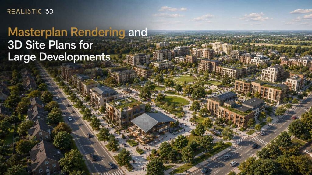
Masterplan rendering turns a large development plan into a visual that makes the whole site easier to understand. It can show buildings, plots, roads, landscape, amenities, public realm, surrounding context, and future phases in one coordinated image or visual set.
A 3D site plan can do something similar at a smaller or more focused scale. It may use a top-down, axonometric, or elevated camera to make the layout easier to read than a technical plan alone.
The goal is not simply to make a masterplan look realistic.
The real job is to show the relationships that matter.
That includes what sits where, how people and vehicles move, which spaces belong together, how the site connects to its surroundings, and what happens in each phase of delivery.
This guide explains how masterplan rendering works, what a useful 3D site plan should show, how phasing and public realm should be handled, when realism helps, when diagrams are better, and how developers can brief a visualization studio without losing the logic of the masterplan.
For the wider architectural visualization process behind these outputs, see our complete guide to 3D architectural rendering.
What is masterplan rendering and how is it different from a 3D site plan?
Masterplan rendering is the visual representation of a large development framework using 2D, 3D, photorealistic, diagrammatic, animated, or interactive imagery. It is used to explain the overall structure of a site, including buildings, land uses, movement, landscape, public realm, infrastructure, and development phases.
Master planning itself is much broader than visualization.
Autodesk describes master planning as the process of planning and organizing the future development of a large site, city, or facility while considering factors such as site potential, community needs, environment, infrastructure, and future development. See Autodesk’s master planning overview.
UK planning guidance uses the term in a similar way. Homes England states that masterplanning is integral to creating well-planned garden communities and involves local authorities, communities, landowners, and other stakeholders. See the Homes England garden communities masterplanning guidance.
Visualization does not create that strategy.
It makes the strategy easier to see.
What is a 3D site plan?
A 3D site plan is a visual representation of a site that adds depth, massing, landscape, roads, buildings, and other spatial information to a conventional plan.
The camera may be:
- Near vertical
- Top down
- Axonometric
- Isometric
- High oblique
- Low oblique
There is no rule that every 3D site plan must use one fixed angle.
The best angle depends on the information.
A near-vertical view is strong for:
- Plot boundaries
- Roads
- Parking
- Landscape zones
- Amenity location
- Sales availability
- Phasing
- Site circulation
An oblique 3D site plan is stronger for:
- Building height
- Roof form
- Massing
- Terrain
- Level changes
- Façade relationship
- Sense of place
The final output may look realistic or diagrammatic.
That is a presentation decision, not a definition.
Is masterplan rendering the same as aerial rendering?
No. The two often overlap, but they are not the same.
Aerial rendering is mainly defined by an elevated camera.
A masterplan visual is defined by the need to explain a large development framework.
A single office building may use an aerial render to show parking and context without needing a masterplan.
A large regeneration project may communicate the masterplan through:
- Top-down site plans
- Land-use diagrams
- Phasing graphics
- 3D massing
- Realistic aerial CGI
- Interactive models
- Flythrough animation
- Annotated plans
The difference is easiest to understand this way.
Aerial rendering asks where should the camera be?
A masterplan visual asks what does the whole development need to communicate?
Our guide to 3D exterior rendering services goes deeper into eye-level, aerial, and dusk camera choices. This article stays focused on large-site communication.
What is the difference between a masterplan and a site plan?
A site plan normally describes a specific site and the physical arrangement of development on it.
A masterplan typically carries a wider strategic role.
It may address:
- Land use
- Development parcels
- Density
- Building scale
- Movement
- Streets
- Public transport
- Green infrastructure
- Public realm
- Landscape
- Community facilities
- Infrastructure
- Phasing
- Delivery
- Relationship to surrounding areas
Welwyn Hatfield Borough Council’s current masterplanning guidance describes a masterplan as a strategy and development framework that responds to a site and its surroundings, with site-specific proposals around scale, layout, mix of uses, transport, and green infrastructure. See its Approach to Masterplanning guidance.
That is why one polished site image is rarely the whole masterplan story.
The visual needs to support the framework behind it.
Why is a 3D masterplan easier for some stakeholders to understand?
A 3D masterplan can reduce the amount of mental translation needed to understand a large site.
A technical plan may show every road, plot, path, boundary, and note accurately.
A non-technical viewer still has to imagine:
- Building height
- Roof form
- Street enclosure
- Landscape maturity
- Public-space character
- Relationship between blocks
- How the site meets existing neighbourhoods
- What the scheme may feel like at full build-out
3D can make those relationships more immediate.
This is especially useful when several disciplines need to discuss the same scheme.
The developer may be thinking about phase viability.
The planner may be thinking about structure and policy.
The landscape architect may be thinking about green links.
The local community may be thinking about roads, open space, and what sits near existing homes.
A good 3D masterplan gives those groups a shared visual reference.
Is masterplan rendering always photorealistic?
No.
A photorealistic final-state image is only one way to visualize a masterplan.
Other useful treatments include:
- Coloured 2D plan
- Clay 3D massing
- Diagrammatic 3D plan
- Land-use overlay
- Phasing diagram
- Movement diagram
- Public-realm diagram
- Landscape strategy view
- Interactive 3D model
- Animated phasing sequence
Photorealism works best when the audience needs to understand the intended character of the completed place.
Diagrammatic visuals work better when the audience needs to understand:
- Ownership
- Land use
- Phase
- Route
- Hierarchy
- Boundary
- Access
- Delivery
Do not force realism onto information that becomes clearer as a diagram.
What should every masterplan visualization make clear?
At minimum, a useful masterplan visualization should help viewers understand the development structure.
A practical review is the PLACE Masterplan Review.
This is a Realistic3D editorial framework, not an official planning standard.
| Letter | Review question | What to look for |
|---|---|---|
| P | Plots | Can viewers see the main development parcels, buildings, uses, and spatial hierarchy? |
| L | Links | Are roads, pedestrian routes, cycle routes, access points, and connections understandable? |
| A | Amenities | Are public realm, landscape, open space, community uses, and key shared facilities clear? |
| C | Context | Can viewers understand the relationship to existing streets, neighbourhoods, terrain, and landmarks? |
| E | Evolution | Can viewers understand what changes over time, including phases, infrastructure, and landscape growth? |
Many weak masterplan visuals handle the first four reasonably well.
The fifth is often missed.
Large developments rarely appear in one instant.
They evolve.
What should a masterplan rendering show on a large development?
A masterplan rendering should show the information that defines how the development works as a place. That normally includes plots and buildings, movement, public realm, landscape, amenities, site context, terrain, infrastructure, and phasing. The level of detail should follow the audience and decision.
The visual should not give every element equal importance.
It needs hierarchy.
How should buildings and development plots be shown?
Buildings should be detailed enough to communicate the development structure without allowing architecture to overwhelm the site logic.
At early design stages, that may mean simple massing.
At later stages, it may include:
- Roof form
- Façade material
- Building entrances
- Balconies
- Ground-floor uses
- Courtyards
- Parking structures
- Landmark buildings
- Active frontages
Plots may be distinguished using:
- Building form
- Landscape
- Road edges
- Colour
- Labels
- Subtle overlays
- Parcel boundaries
The correct method depends on whether the visual is being used for design, planning, investment, sales, or community communication.
One final-state render may show the future place.
A companion diagram can show the parcels more explicitly.
That is usually clearer than trying to make one image perform both jobs at once.
How should land uses be communicated?
Use visual hierarchy rather than relying only on labels.
A mixed-use masterplan may contain:
- Housing
- Retail
- Offices
- Schools
- Healthcare
- Community buildings
- Leisure
- Hotels
- Industrial or logistics uses
- Public open space
A photorealistic masterplan can suggest these uses through architecture, public activity, landscape, entrances, and ground-floor treatment.
A land-use diagram should make them explicit through a controlled colour system.
Both are useful.
The realistic image answers:
What may this place feel like?
The diagram answers:
What goes where?
For a large investor or stakeholder presentation, those two answers often belong beside each other.
How should roads and vehicle movement appear?
Roads should be easy to understand without becoming the dominant visual feature.
The masterplan may need to communicate:
- Main access
- Secondary streets
- Service access
- Parking
- Drop-off
- Bus routes
- HGV movement
- Emergency access
- Car-free zones
- Shared surfaces
Vehicle graphics can establish scale and movement.
They should not imply technical analysis that the image does not perform.
A 3D site plan can show a lorry route.
It does not replace a swept-path analysis.
A 3D site visual can show a junction.
It does not prove capacity.
Keep the visual aligned with the evidence behind it.
How should pedestrian and cycle movement be shown?
Pedestrian and cycle routes should be visible whenever movement through the site is part of the masterplan logic.
They can be communicated through:
- Paths
- Paving
- Crossings
- Landscape edges
- Street hierarchy
- People and cyclists
- Overlays
- Arrows
- Labels
- Diagrammatic companion views
Do not rely on tiny people alone to explain movement.
At masterplan scale, entourage may be too small to carry the information.
A clean movement diagram can often make the route structure much clearer.
The 3D masterplan then shows what those routes may feel like as part of the future place.
Why is public realm so important in masterplan rendering?
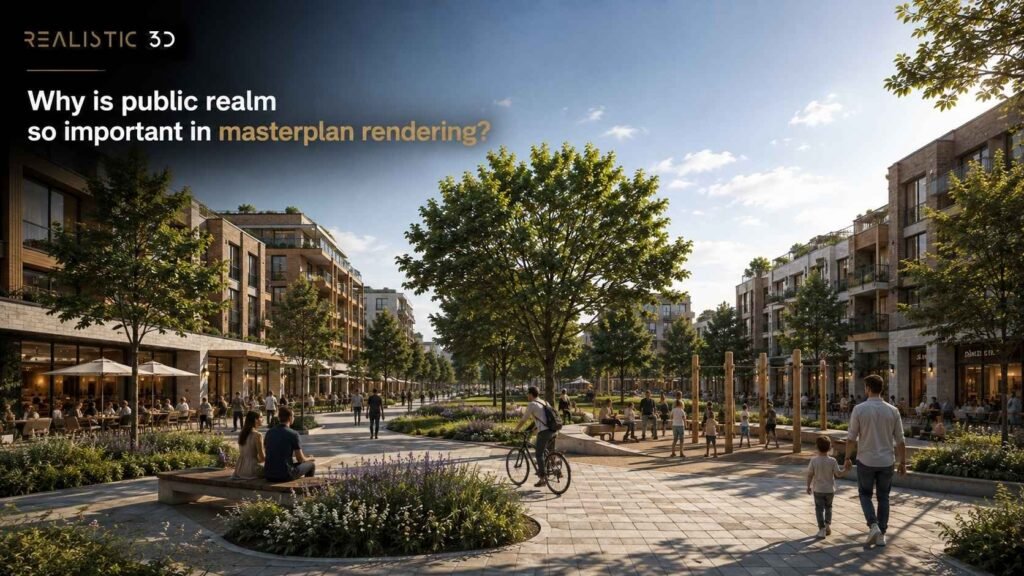
Public realm often creates the connective tissue between buildings.
A weak masterplan render can make a large development look like a collection of isolated objects.
A stronger one shows how buildings relate through:
- Streets
- Squares
- Courtyards
- Parks
- Promenades
- Play spaces
- Plazas
- Green corridors
- Water edges
- Paths
- Landscape buffers
UK design guidance treats public realm and graphical communication as part of the wider design framework. Government guidance on creating design codes says design codes should include clear and specific design requirements and normally include extensive graphical illustrations, building from a design vision such as a masterplan. See Creating a design code.
The practical visualization lesson is simple.
Do not model only the buildings.
Model the spaces that make the buildings belong to one place.
How should landscape appear in a 3D site plan?
Landscape should show structure before decoration.
At masterplan scale, the important landscape questions may include:
- Where are the main green spaces?
- Which routes are tree-lined?
- Where are buffers needed?
- How do parks connect?
- Where is water?
- Which courtyards are private?
- Which open spaces are public?
- How does planting relate to streets?
- How does green infrastructure connect across the site?
Large areas of detailed planting can make an image attractive while hiding the real landscape hierarchy.
Start with:
- Major open spaces
- Tree structure
- Green corridors
- Paths
- Water
- Courtyards
- Buffer planting
- Detailed planting where visible
Tree maturity also needs control.
The final build-out landscape may look different at year one, year five, and year fifteen.
If landscape establishment matters to the decision, show the relevant stage rather than an undefined mature future.
How should terrain and level changes be handled?
Terrain should be part of the base model when slopes affect the masterplan.
Level changes can influence:
- Building height
- Views
- Retaining walls
- Accessibility
- Road gradients
- Public spaces
- Drainage
- Landscape
- Entrances
- Cut and fill
- Skyline
A flat visualization of a sloping site can hide these relationships.
The terrain may come from:
- Topographic survey
- Civil model
- Contours
- GIS
- LiDAR
- BIM
- Site data
At early stage, simplified terrain may be enough.
At later stages, especially where levels are critical, the visualization should follow controlled data.
How much surrounding context should be included?
Include the context needed to explain how the masterplan relates to its surroundings.
Useful context may include:
- Existing neighbourhoods
- Major roads
- Rail
- Public transport
- Parks
- Rivers
- Coast
- Schools
- Town centres
- Employment areas
- Key landmarks
- Adjacent development
- Terrain
Ordnance Survey provides mapping and imagery products covering buildings, roads, terrain, natural spaces, and other geographic features that can support UK site-context work. See Ordnance Survey maps and imagery.
The context radius should follow relevance.
A nearby station may be central to the masterplan story.
A distant building with no relationship to the site may add clutter.
At planning or evidence-led stages, the context requirement may be controlled by a separate methodology.
How should amenities and community facilities be shown?
Amenities should be visible enough to explain why they matter in the development structure.
Examples include:
- School
- Community centre
- Sports facility
- Retail
- Play area
- Health facility
- Park
- Clubhouse
- Gym
- Shared workspace
- Public square
- Waterfront
- Mobility hub
A 3D masterplan can use architecture, activity, signage, and landscape to make these uses recognizable.
An annotated 3D site plan can make them explicit.
If amenity location is a sales benefit, consider producing a clean buyer-facing version with simple labels.
If amenity delivery depends on phase, show that too.
A feature that arrives in Phase 4 should not accidentally appear to be available from the first occupation if the visual is used commercially.
What should be simplified?
Simplify any detail that does not affect the current decision.
At masterplan scale, unnecessary detail creates:
- Longer modeling time
- Slower rendering
- Visual clutter
- Higher revision cost
- More opportunities for outdated information
A distant residential block may need:
- Correct footprint
- Correct height
- Roof form
- Façade rhythm
- General material
It may not need:
- Door handles
- Internal furniture
- Detailed drainage
- Small façade fixings
A key landmark building may need more.
The right question is:
Will this detail change what the viewer understands from this camera?
If not, it may not deserve equal production effort.
How do you show phasing, infrastructure, and change over time?
Masterplan phasing should be shown as a sequence of controlled states rather than one final image with arbitrary colour overlays. The base site should remain consistent while buildings, roads, landscape, infrastructure, and amenities change by phase. This lets stakeholders understand not only the final place but the route to getting there.
Phasing is one of the strongest reasons to use 3D masterplan visualization.
Why is phasing a separate visualization problem?
Because a completed masterplan can hide the logic of delivery.
A final-state image may show:
- 1,000 homes
- School
- Park
- Retail
- New road
- Community building
- Landscape
- Public square
The development may actually be built over ten years.
The important questions become:
- What happens first?
- Which road enables Phase 2?
- When does the school arrive?
- What landscape exists during early phases?
- Which plots remain undeveloped?
- How does a temporary site edge look?
- Which amenities are available at each stage?
Those are not final-state questions.
They are time questions.
The Local Government Association’s strategic-sites toolkit notes that stages in large-site delivery can overlap and that decisions or delays at one stage can affect later stages. See Effective delivery of strategic sites.
The visualization becomes more useful when it makes that dependency visible.
What is the cleanest way to visualize phases?
Use one fixed base and change only the information that genuinely changes.
For example:
Existing
- Current roads
- Existing buildings
- Existing landscape
Phase 1
- First development plots
- Enabling road
- Temporary landscape edge
Phase 2
- Additional housing
- New public space
- Expanded road network
Phase 3
- School or commercial centre
- Further housing
- Green link extension
Full build-out
- Completed development
- Mature landscape assumption
- All planned facilities
Keep camera, scale, orientation, and background consistent.
That makes comparison easy.
If the camera moves between every phase, the viewer has to learn the site again each time.
Should phases use colour or photorealism?
Use colour when distinction matters more than atmosphere.
Use photorealism when the audience needs to understand the experience of a specific phase.
A useful system may include:
- Colour-coded phasing plan
- 3D phase snapshots
- Final photorealistic masterplan
- Short phasing animation
Do not make the final-state image carry every phase label.
That usually creates clutter.
A simple diagram can communicate timing more clearly.
How should enabling infrastructure be shown?
Show infrastructure when it changes what can be delivered or how the site works.
That may include:
- Main access road
- Bridge
- Utility corridor
- Drainage feature
- School
- Transport link
- Public-realm spine
- Green infrastructure
- Parking
- Service route
Large sites often depend on infrastructure that arrives before the buildings it serves.
If the final visual only shows completed buildings, that dependency disappears.
For stakeholder or investor presentations, a phase diagram can show which enabling works unlock later parcels.
Keep the language accurate.
A visualization may show the relationship.
It does not prove engineering capacity or programme certainty.
How do you show public realm across phases?
Public realm should not appear fully mature in every phase unless that matches the delivery plan.
A phased model can show:
- Temporary boundaries
- Part-complete streets
- Early planting
- Finished park areas
- Unbuilt future plots
- Interim pedestrian routes
- Completed public squares
- Later landscape growth
This is more honest than pasting the full mature landscape into Phase 1.
It also helps teams discuss the experience of early occupants.
A masterplan can be successful at full build-out and uncomfortable during early years if temporary edges, routes, or amenities are ignored.
Visualization can expose that issue before construction.
Can animation show masterplan phasing better than stills?
Yes, when the order of change matters.
A short animation can show:
- Existing site
- Enabling works
- Phase 1
- Phase 2
- Phase 3
- Full build-out
It can also combine phase growth with a camera move through the development.
Use that carefully.
If too much changes at once, the viewer may miss the information.
A fixed or slow camera with clear phase transitions can be more informative than a cinematic flythrough.
For masterplans where site orientation and movement both matter, see our guide to architectural flythroughs for large sites and masterplans.
Realistic3D’s 3D animation service can also support site or development animation when a still-image set cannot explain the sequence clearly.
Can an interactive 3D masterplan show phases?
Yes.
A real-time or interactive model can allow users to:
- Toggle phases
- Select plots
- Show land uses
- Turn landscape layers on and off
- Highlight roads
- View amenities
- Move between cameras
- Inspect building types
- Compare options
That can be valuable for complex stakeholder sessions or property sales.
It also creates a stricter scene-management requirement.
Every phase, object, label, and interaction needs a controlled data structure.
An interactive model is not simply a rendered image with buttons.
It is a digital product built on the masterplan data.
How should design changes be managed across a masterplan model?
Use a controlled source and a clear change log.
Large developments often change in parts.
One block changes height.
One road moves.
A plot changes use.
The landscape strategy evolves.
A school moves to another phase.
If every change arrives as an isolated screenshot, the visualization model becomes hard to trust.
Track:
- Revision
- Date
- Area affected
- Source file
- Nature of change
- Views affected
- Phases affected
- Whether previous visuals are superseded
The same logic used in smaller architectural rendering becomes more important as the site gets larger.
Our guide to 3D rendering for construction companies shows how visualization can also support construction sequencing and stakeholder communication later in the project lifecycle.
How should developers, architects, and planners use masterplan rendering?
Use masterplan rendering when the next decision depends on understanding relationships across the whole site. The visual can support planning, stakeholder engagement, investor communication, property marketing, construction sequencing, and design review, but the evidence standard and graphic treatment should change with the audience.
The same model can support several outputs.
The same image should not be reused blindly for every purpose.
How does masterplan rendering support planning communication?
A well-structured 3D masterplan can make a large proposal easier to understand.
It may help show:
- Scale
- Layout
- Land-use relationships
- Access
- Movement
- Open space
- Public realm
- Green infrastructure
- Building massing
- Site context
- Phasing
UK planning guidance treats masterplanning as a collaborative framework rather than a single image. Homes England’s garden communities guidance emphasizes vision, stakeholder engagement, local context, and coordinated design across large developments. Read the Homes England masterplanning guidance.
Visualization supports that process by making selected parts easier to discuss.
It should not pretend to replace:
- Planning policy
- Design code
- Transport analysis
- Landscape assessment
- Survey
- Technical drawings
- Environmental assessment
- Infrastructure strategy
The image communicates evidence.
It is not all the evidence.
Is masterplan rendering suitable for consultation?
Yes, especially when technical plans are difficult for a general audience to interpret.
A consultation visual can show:
- Development extent
- Streets
- Homes
- Parks
- Community facilities
- Main routes
- Character areas
- Landscape
- Development phases
The visual should remain neutral enough to support an informed discussion.
Avoid using a highly polished image to make an unresolved proposal look more fixed than it is.
Where options remain open, show them clearly.
Where an element is illustrative, label it.
Masterplan communication works best when it reduces confusion without removing uncertainty that genuinely exists.
Can a 3D masterplan help investor presentations?
Yes.
Investors often need to understand scale and development logic quickly.
A useful investor visual set may include:
- Final masterplan rendering
- Phasing plan
- Land-use plan
- Hero aerial
- Key public-realm image
- Representative building image
- Infrastructure diagram
- Short flythrough
The masterplan view provides the overview.
The other assets explain the investment story in layers.
For commercial and mixed-use developments, our commercial architectural rendering guide explains why stakeholder visuals should be chosen around decisions rather than image count.
How does masterplan rendering support property sales?
For large residential or mixed-use developments, a rendered masterplan can help buyers understand where an individual property sits within the wider place.
That may include:
- Plot location
- Park proximity
- Road relationship
- Amenity location
- Walking routes
- Phase
- View direction
- Parking
- Community facilities
A buyer-facing version may need simple labels.
An interactive version may allow plot selection.
A brochure version may use a cleaner, more emotional final-state image.
For residential schemes, see our residential architectural rendering guide for the wider mix of development, street, house, interior, and sales visuals.
When is a 2D site plan better than a 3D masterplan?
Use a 2D site plan when exact plan relationships need to be read quickly and visual depth adds little.
2D may be better for:
- Plot numbers
- Boundaries
- Dimensions
- Areas
- Legal plans
- Technical coordination
- Sale status
- Phase colouring
- Land-use colouring
- Road labels
- Detailed annotation
3D is better when the viewer needs help interpreting:
- Height
- Massing
- Terrain
- Building relationships
- Landscape
- Character
- Experience
- Future appearance
The strongest large-development communication often uses both.
2D explains the rules. 3D explains the place.
When is aerial CGI better than a 3D site plan?
Use aerial CGI when the development needs a more photographic and place-led image.
Use a 3D site plan when clarity of arrangement matters more.
Aerial CGI is stronger for:
- Launch hero
- Architecture
- Skyline
- Building character
- Context
- Investor presentation
- Marketing
A 3D site plan is stronger for:
- Plot location
- Amenity map
- Phasing
- Site hierarchy
- Sales availability
- Land-use explanation
- Roads and open space
Do not treat them as competing formats.
They can come from the same underlying 3D masterplan model.
How can one masterplan model produce several assets?
A well-built masterplan model can support:
- Final aerial CGI
- Top-down 3D site plan
- Phasing views
- Land-use graphics
- Public-realm views
- Eye-level exteriors
- Flythrough animation
- Investor visuals
- Sales maps
- Interactive site selectors
- Social and brochure crops
Reuse works best when it is planned early.
Tell the visualization studio if the model may later support:
- Animation
- Interactive 3D
- Multiple phases
- Plot selectors
- Large-format print
- Eye-level close-ups
A model optimized only for one high aerial may not contain enough detail for a later street-level animation.
A model built only for still images may need restructuring for real-time interaction.
What files are needed for masterplan rendering?
The source package may combine information from several disciplines.
Useful inputs include:
- Current masterplan
- Site plan
- Architectural models
- Building footprints
- Massing
- Civil model
- Topographic survey
- Landscape plan
- Public-realm plan
- Roads
- Parking
- Phasing plan
- Land-use schedule
- Plot schedule
- Building-type schedule
- Existing context
- GIS data
- Aerial imagery
- Planning boundary
- Material references
- Key views
- Design code
- Written brief
The visualization team also needs to know which source controls each part of the model.
Large sites often contain conflicting information because different consultants update at different times.
Document control is part of visualization quality.
How should a masterplan brief be written?
Start with the audience and unanswered question.
Weak brief:
Create one high-quality masterplan render.
Stronger brief:
Create a masterplan rendering that lets planning stakeholders understand the relationship between the residential plots, central park, school site, primary access, and future Phase 2 land. Use the current Phase 1 landscape plan and show Phase 2 as simplified massing rather than final architecture.
That brief tells the visualization team:
- Audience
- Purpose
- Key content
- Phase status
- Detail hierarchy
- Evidence boundary
Also state:
- Current revision
- Camera preference
- Required output type
- Labels
- Phase treatment
- Final resolution
- Deadline
- Review owner
- Intended use
How many masterplan views does a large project need?
There is no fixed number.
A project needs enough views to explain distinct information without repeating the same overview.
A useful package may include:
- Final-state masterplan
- Phasing graphic
- Land-use or programme diagram
- Hero aerial
- Key public-realm perspective
- Eye-level arrival view
- Flythrough where movement adds value
A smaller site may need only:
- One 3D site plan
- One eye-level exterior
Do not commission several high aerials that show almost the same thing.
Every output should answer a new question.
How much does masterplan rendering cost?
Masterplan rendering cost depends on site size, number of buildings, available model data, context, terrain, landscape, phasing, output type, and required level of detail.
Main cost drivers include:
- Number of parcels
- Number of building types
- Context modeling
- Terrain
- Landscape
- Infrastructure
- Public realm
- Phasing
- Number of cameras
- Animation
- Interactive outputs
- Final resolution
- Revision scope
- Design changes
A 20-home site plan and a 5,000-home new settlement are both masterplan visualization tasks.
They are not comparable production scopes.
For wider architectural visualization pricing, see our 2026 architectural 3D rendering cost guide.
How can you review a masterplan rendering in 60 seconds?
Use the PLACE review.
Plots
Can you understand the main buildings, parcels, and hierarchy?
Links
Can you see how vehicles, pedestrians, and cyclists move through and connect to the site?
Amenities
Can you identify the important public realm, landscape, open spaces, and shared facilities?
Context
Can you understand how the development relates to existing roads, neighbourhoods, terrain, and landmarks?
Evolution
Can you tell what is final, what is future, and what changes by phase?
Then perform one final test.
Purpose
Is the visual appropriate for how it will actually be used?
A marketing masterplan may be persuasive and still be unsuitable as formal visual evidence.
A planning diagram may be accurate and still be too technical for a buyer campaign.
Good masterplan visualization is not just about image quality.
It is about matching visual evidence to the decision.
Frequently asked questions about masterplan rendering
What is masterplan rendering?
Masterplan rendering is the visual representation of a large development plan. It can show buildings, plots, land uses, roads, pedestrian routes, landscape, public realm, amenities, infrastructure, context, and development phases. The output may be a photorealistic aerial, a 3D site plan, a diagram, an animation, or an interactive model depending on what the audience needs to understand.
What is the difference between a masterplan rendering and a site plan rendering?
Masterplan rendering usually explains a broader development framework, including multiple parcels, uses, movement systems, public realm, infrastructure, and phasing. Site plan rendering usually focuses on the physical arrangement of one site. The two overlap, especially on large projects, and both can use top-down, axonometric, oblique, realistic, or diagrammatic presentation styles.
How is a 3D site plan made?
A 3D site plan is normally created from architectural, civil, survey, landscape, and site information. The visualization team builds or imports terrain, roads, buildings, landscape, parking, amenities, and surrounding context. It then selects a clear camera, applies materials and lighting, and reviews the output against the current project sources.
How do you show phasing in a masterplan?
Show phasing as a sequence of controlled site states. Keep the same base model, orientation, and camera while buildings, roads, amenities, landscape, and infrastructure change by phase. Use colour-coded diagrams for clear timing and 3D snapshots when viewers need to understand what each phase may look like as a place.
What should a masterplan rendering show about public realm?
A masterplan rendering should show the public spaces that connect buildings and movement. Depending on the project, this can include streets, squares, parks, courtyards, promenades, play areas, paths, water edges, green corridors, and landscape buffers. Public realm should read as part of the site structure rather than as decorative space left between buildings.
Can masterplan rendering be used for planning applications?
Yes. Masterplan rendering can support planning communication by making layout, scale, movement, landscape, public realm, context, and phasing easier to understand. It does not replace planning policy, technical drawings, surveys, transport work, landscape assessment, or other evidence. The required visualization method depends on how the image will be used.
Is a 3D masterplan useful for property marketing?
Yes, especially on developments where buyers need to understand plot location, amenities, roads, parks, phases, and the relationship between several buildings. A buyer-facing masterplan can be simplified and labelled, while a hero aerial can show the final character of the place. Interactive versions can also support plot or unit selection.
What files are needed for masterplan rendering?
Useful inputs can include the masterplan, site plan, architectural models, civil files, topographic survey, landscape plan, public-realm design, roads, parking, phasing plan, land-use schedule, plot schedule, context data, GIS, aerial imagery, planning boundary, design code, and a clear written brief. The exact package depends on scale and intended use.
Conclusion
A masterplan visual works when it turns a large development into a clear set of relationships.
Buildings matter, but so do the roads between them, the park beside them, the public square they face, the infrastructure that enables them, and the phases that bring them into existence.
That is why the strongest masterplan visual is rarely just a beautiful aerial.
It should make plots, links, amenities, context, and evolution easy to understand.
Use photorealism when people need to see the future place.
Use diagrams when they need to understand the system.
Use phasing when they need to understand time.
When those layers work together, a masterplan stops being a dense drawing that only the project team can decode and becomes a visual framework that stakeholders can actually discuss.
