

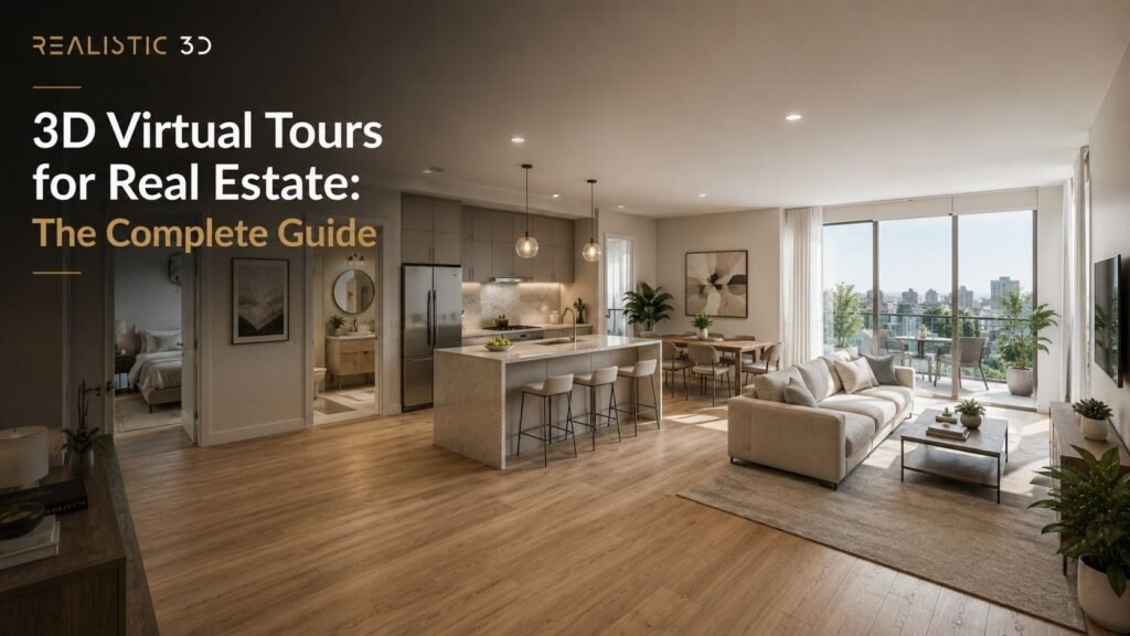
A property listing can have excellent photographs and still leave a buyer with a basic problem.
They can see the kitchen. They can see the living room. They can see the main bedroom.
They may not understand how those spaces connect.
A 3D virtual tour is an interactive digital representation of a property that lets a viewer move through the space remotely, look around in different directions, and understand room-to-room relationships at their own pace. Depending on the system, the tour may also include a dollhouse view, floor plan, measurements, tags, still images, and other digital assets.
That definition sounds simple. The market around it is not.
The phrase 3D virtual tour is used for several different products. A Matterport digital twin captured from an existing property is not the same as a basic chain of 360 panoramas. A rendered 360 experience for an unbuilt apartment is not the same as scanning a finished home. A video walkthrough is not interactive at all.
Choosing the right format starts by identifying which reality you need to show.
- Existing property: capture the real space.
- Unbuilt property: render the proposed space.
- Guided story: use video or animation.
- Self-guided exploration: use an interactive tour.
This guide explains how 3D virtual tours work, how Matterport differs from simpler 360 tours, what LiDAR changes, what deliverables you can receive, how floor plans fit into the workflow, what happens to hosting and downloadable data, and when a virtual tour is actually worth commissioning.
Realistic3D provides Matterport 360 virtual tour services for existing spaces and VR and AR visualization for spaces that need to be explored before they are built. The distinction between those two services is one of the most important ideas in this guide.
What is a 3D virtual tour and how is it different from 360, video, and CGI?
A 3D virtual tour is a self-guided interactive experience that gives a remote viewer spatial context inside a property. The viewer can normally choose where to move and where to look instead of following one fixed camera path.
The National Association of REALTORS describes a virtual tour as an interactive experience that lets potential buyers explore a property from another location. Its 2025 virtual tour playbook highlights the value of showing how rooms connect rather than presenting isolated photographs.
That room-to-room relationship is the core benefit.
The technology used to create it can vary widely.
What does 3D mean in a 3D virtual tour?
The word 3D usually means the tour carries some form of spatial relationship between capture positions or modeled spaces.
A true spatial tour may understand more than the image at each camera point. It can also understand where those camera points sit in relation to the room or building.
Matterport calls its captured property model a digital twin. Its platform can connect 360 imagery with spatial data to create navigable views such as walkthrough and dollhouse modes. Matterport’s current real estate platform is designed around that type of interactive property representation.
A simpler 360 tour may work differently.
It can consist of panoramic photographs connected by hotspots. The viewer clicks from one panorama to another. That can still be a useful virtual tour, but it may have less underlying spatial information.
This is why the words 360 and 3D should not automatically be treated as synonyms.
What is a 360 virtual tour?
A 360 virtual tour is an interactive experience built from panoramic images that let the viewer look in every direction from selected camera positions.
A basic workflow can be:
- Capture a 360-degree panorama in the entrance.
- Capture another panorama in the living room.
- Capture another in the kitchen.
- Link those positions.
- Add arrows or hotspots for navigation.
Academic work on automated real-estate tours describes the common model as capturing equirectangular 360 images and then connecting those images to create a walkthrough experience. See the paper DIGITOUR: Automatic Digital Tours for Real-Estate Properties.
A 360 tour can be simple, fast, and effective.
It does not automatically provide the same spatial model, measurement tools, floor-plan workflow, or dollhouse presentation associated with more advanced digital-twin platforms.
What is a Matterport 3D virtual tour?
A Matterport 3D virtual tour is an interactive property experience created inside Matterport’s capture and hosting ecosystem.
Depending on the capture device, subscription, property, and selected add-ons, a Matterport workflow can support outputs such as:
- Interactive walkthrough
- Dollhouse-style overview
- Floor-plan view
- Schematic 2D floor plan
- Measurements
- Tags
- Still images
- Shareable tour link
- Website embed
- Downloadable spatial assets
- Point-cloud or other AEC-oriented exports where purchased and supported
Matterport states that its platform supports capture ranging from smartphones and compatible 360 cameras to its professional Pro3 LiDAR camera. See Matterport’s capture platform and its list of supported 360 cameras.
This flexibility is important.
Matterport is a platform, not one single camera.
The capture method changes the data quality, speed, range, and use cases available.
Is a virtual tour the same as a video walkthrough?
No.
A video walkthrough has a fixed sequence. The editor decides:
- Where you start
- Which room comes next
- How long you see it
- Where the camera looks
- When the video ends
A 3D virtual tour is normally non-linear.
The viewer decides where to go.
| Format | Who controls the route? | Best at | Main limitation |
|---|---|---|---|
| Listing photos | Photographer | Fast visual scanning | Weak room-to-room context |
| Video walkthrough | Filmmaker | Story, pace, emotion | Viewer cannot choose the route |
| 360 tour | Viewer | Looking around from selected points | Spatial data varies by system |
| 3D virtual tour | Viewer | Self-guided spatial exploration | Requires capture, processing, and hosting |
| 2D floor plan | Viewer | Layout and dimensions | Less immersive |
| CGI walkthrough | Filmmaker | Guided view of an unbuilt property | Fixed path |
| Rendered 360 / VR | Viewer | Exploring a proposed property | Must be built from design data |
Matterport makes the same broad distinction in its guide to video walkthroughs versus 3D tours, noting that an interactive tour lets the viewer inspect the property rather than only seeing the route chosen for a video.
The choice is not which format is more advanced.
It is which format answers the buyer’s next question.
What is the difference between a virtual tour and an architectural walkthrough?
A captured virtual tour documents a space that exists.
An architectural walkthrough can show a space before it exists.
Realistic3D’s guide to architectural walkthroughs for unbuilt property buyers explains how CGI can create a guided journey through a proposed development using drawings and 3D models.
That workflow starts with design information.
A Matterport tour starts with physical capture.
This distinction matters for property developers.
If the apartment block is finished, capture may be the most truthful route.
If the project exists only as CAD, BIM, or drawings, there is nothing to scan yet. The experience has to be rendered from the proposed design.
Can you create a virtual tour for an unbuilt property?
Yes, but it is a different production process.
For an unbuilt property, a visualization studio can create:
- 360-degree CGI panoramas
- Linked rendered rooms
- Interactive WebGL experience
- Real-time 3D environment
- VR experience
- Guided CGI walkthrough
- Interactive unit selector
Realistic3D’s VR and AR visualization service is designed for this type of pre-build exploration.
Matterport also documents an option to import 360 spherical imagery into a Matterport model, including 360 CGI imagery in suitable workflows. See Matterport’s 360 spherical image import guidance.
The accuracy question is different for rendered tours.
A capture records what was physically there.
A CGI tour represents a proposed condition and must be checked against the current design.
Which virtual-tour type should you choose?
Use five questions before choosing a platform or camera.
| Question | If yes | If no |
|---|---|---|
| Does the property physically exist? | Consider capture-based tours | Use CGI or real-time visualization |
| Does the viewer need to choose their own route? | Use interactive tour | Consider video or animation |
| Do measurements or spatial exports matter? | Choose a spatially aware capture system | A simpler 360 tour may be enough |
| Do you need floor plans or multiple assets from one visit? | Choose a workflow built for asset reuse | A standalone tour may be enough |
| Do you need control over hosting, transfer, or downloadable data? | Define this before capture | Standard hosted delivery may be enough |
This decision table prevents a common mistake.
Do not choose Matterport because the name is familiar.
Do not choose a simple 360 tour because it is cheaper.
Choose the workflow that produces the information and outputs your property actually needs.
How does a 3D virtual tour work from capture to live link?
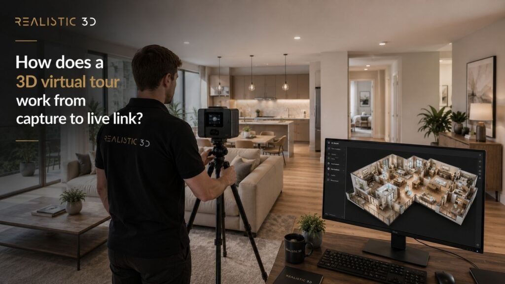
A capture-based 3D virtual tour is created by recording the property from multiple positions, processing those captures into a connected digital experience, reviewing the navigation and privacy, then publishing the tour through a hosted link or website embed.
The process is simple for the viewer.
The capture stage needs more care.
Step 1. Prepare the property before capture
A virtual tour records much more than one photograph.
The viewer can turn around.
They can look into corners.
They can move back through a room.
That means staging and privacy need more attention than they do for a few selected listing photographs.
Before capture:
- Remove clutter
- Hide personal documents
- Remove sensitive photographs where needed
- Make beds
- Clear kitchen surfaces
- Close cupboards unless they are meant to be shown
- Clean mirrors
- Check bathrooms
- Turn on appropriate lights
- Open or close blinds consistently
- Remove bins
- Move temporary maintenance items
- Confirm which rooms should be excluded
- Check that doors along the tour route can be opened safely
This is especially important in occupied homes, offices, schools, healthcare sites, and commercial spaces.
A virtual tour can reveal details that were not obvious during the shoot.
Privacy review should happen before publication, not after a viewer finds the problem.
Step 2. Plan the scan route
The capture operator plans where the camera needs to stand so the software can connect the property into a usable path.
Good scan placement supports:
- Continuous navigation
- Doorway transitions
- Stairs
- Corridors
- Large open rooms
- Multiple floors
- Outdoor-to-indoor transitions where supported
- Dollhouse geometry
- Spatial alignment
Too few positions can create awkward jumps.
Too many positions can increase capture time without improving the experience.
The route should also match the property story.
A viewer should not enter through a service cupboard just because that was convenient for scanning.
Start the tour from a position that makes sense to the audience whenever the platform allows it.
Step 3. Capture the space
Capture method can range from a phone to a professional LiDAR camera.
Matterport currently supports several capture categories:
- Mobile devices in supported workflows
- Compatible 360 spherical cameras
- Matterport Pro2
- Matterport Pro3
- Mixed capture workflows in some cases
Matterport’s current support documentation confirms that supported 360 cameras can be used with the Matterport platform, and its quick-start guidance allows compatible 360-camera captures to be combined with Pro-camera scans inside the same model in supported workflows.
The right device depends on what you need from the tour.
What is the difference between LiDAR, a 360 camera, and a phone?
The main difference is how each device captures visual and spatial information.
LiDAR measures distance using laser pulses. It is useful when the workflow needs stronger depth information, larger capture ranges, or spatial outputs.
360 cameras capture panoramic imagery quickly. They can be cost-effective for property tours where visual exploration is the main goal.
Phones and tablets can be convenient for lighter capture workflows, depending on the supported device and platform.
Matterport describes the Pro3 as its professional camera designed around LiDAR-based spatial capture, while its ecosystem also supports selected 360 cameras and mobile workflows.
| Capture method | Best suited to | Main strength | Main consideration |
|---|---|---|---|
| Professional LiDAR capture | Higher-value, larger, AEC, commercial, spatial workflows | Stronger spatial capture and range | Higher equipment and service cost |
| Professional 3D camera | Real estate and structured tour capture | Integrated spatial workflow | Platform-specific workflow |
| Supported 360 camera | Residential tours and efficient capture | Fast panoramic capture | Spatial performance depends on system |
| Phone or tablet | Lightweight and accessible capture | Convenience | Quality and capabilities vary by device |
Do not judge the output only by how sharp the panorama looks.
If you later need point-cloud data, CAD support, measurement, or facility documentation, capture method matters more.
Step 4. Process the captures into a digital twin or linked tour
After capture, the platform processes the images and spatial information.
In a Matterport workflow, the result can become a digital twin with connected scan positions and several viewing modes.
In a simpler 360 workflow, the photographer or platform may link panoramas manually or automatically.
The processing stage can involve:
- Image stitching
- Alignment
- Spatial reconstruction
- Room connection
- Navigation generation
- Dollhouse creation
- Floor-plan view generation
- Image processing
- Tour hosting
The viewer does not see most of this work.
They see a link that opens and works.
That is why a high-quality tour can feel deceptively simple.
Step 5. Edit navigation, starting point, tags, and privacy
A raw processed tour is not always publication-ready.
Review:
- Starting position
- Navigation route
- Hidden rooms
- Mirrors
- Personal details
- Screens
- Licence plates where relevant
- Faces where privacy requires treatment
- Scan points outside the property
- Unwanted exterior areas
- Tags and labels
- Property information
- Branding
- Contact links
Interactive tags can add context.
For example, a commercial-property tour may label:
- Meeting room capacity
- Equipment
- Floor finish
- Access point
- Plant room
- Available unit
- Amenity
- Specification
Use tags to answer questions.
Do not turn the tour into a field of advertising popups.
Step 6. Create floor plans and supporting assets
One of the strongest reasons to use a structured capture platform is asset reuse.
Matterport’s current real-estate product pages describe a workflow where a digital twin can support additional outputs such as floor plans and property imagery. Matterport also offers a dedicated Schematic Floor Plan service that creates 2D plans from a captured model without a second property visit.
This can reduce duplicate capture.
Depending on the service package, a property team may receive:
- 3D virtual tour
- Schematic floor plan
- Still photos
- Dollhouse image
- Floor-plan image
- Tour link
- Embed code
- Tags
- Measurement tools
- Teaser assets
- Downloadable spatial data where ordered
The phrase 3D virtual tour service therefore needs a clear scope.
Ask what is included rather than assuming every provider delivers the same bundle.
Step 7. Publish the tour
Most virtual tours are published as a hosted web experience.
Common delivery options include:
- Shareable URL
- Embedded iframe
- Property website
- Portal link
- QR code
- Sales presentation
- Digital brochure
- Google Street View integration where supported and appropriate
Realistic3D’s Matterport 360 service is designed around remote exploration of captured real spaces through an interactive tour.
The tour should be tested on:
- Desktop
- Mobile
- Tablet
- Wi-Fi
- Mobile data
- Property website
- Any target listing portal
A technically good tour can still underperform as an experience if it takes too long to load or the embed is difficult to find.
How long does a 3D virtual tour take to create?
The timeline depends on property size, number of floors, room complexity, capture method, access, and the deliverables ordered.
There are two separate time periods:
On-site capture time
- Travel
- Setup
- Property preparation
- Scanning
- Moving through floors
- Rescanning difficult areas
Post-capture time
- Processing
- Quality check
- Editing
- Privacy
- Tags
- Floor-plan orders
- Branded delivery
- Client review
A small empty apartment can be much faster than a furnished hotel, school, warehouse, or large commercial property.
Do not estimate a project only from floor area.
Access and complexity matter.
How should a property be prepared for a Matterport tour?
Prepare the property as though every direction may appear in the final marketing.
That means:
- Finish cleaning before the operator arrives
- Decide whether doors stay open or closed
- Remove personal data
- Stage furniture
- Replace damaged bulbs
- Hide cleaning equipment
- Remove temporary signage
- Clear parked vehicles if exterior capture matters
- Secure pets
- Confirm restricted rooms
- Tell occupants when scanning will happen
- Check mirrors and reflective surfaces
- Make sure key spaces are accessible
The 3D virtual tour should represent the property condition you are comfortable leaving online.
Unlike a live viewing, it can be revisited repeatedly.
What do you actually receive from a virtual tour service?
A professional 3D virtual tour service may deliver much more than an interactive walkthrough. Depending on the platform and package, the project can also produce floor plans, still images, dollhouse views, tags, measurements, downloadable point clouds, CAD-related assets, and reusable spatial data.
This is where buyers should look beyond the headline price.
The tour is only one part of the deliverable.
What is normally included in a real estate virtual tour?
A basic virtual-tour package commonly includes:
- Property capture
- Hosted interactive tour
- Public share link
- Website embed
- Basic editing
- Starting-view setup
A more complete package may add:
- 2D floor plan
- Dollhouse view
- Still photographs
- Short teaser clip
- Property labels
- MatterTags or information hotspots
- Measurements
- Branding
- MLS-compatible presentation
- Downloadable assets
- Commercial or AEC data products
Ask for a written deliverables list.
Terms such as premium, pro, 3D, digital twin, and immersive do not define scope by themselves.
Can a virtual tour generate a floor plan?
Yes, some 3D virtual tour platforms can generate floor-plan products from captured spatial data.
Matterport’s Schematic Floor Plans are generated from the captured Matterport model and can be ordered without another site visit.
This is useful for real estate because a tour and floor plan answer different questions.
The tour says:
How does it feel to move through this property?
The floor plan says:
How is this property arranged?
NAR’s 2025 virtual-tour guidance calls floor plans an important companion asset because they help buyers understand room sizes and layouts.
For rendered rather than captured property plans, see Realistic3D’s wider architectural rendering services, which can create visual assets from drawings and models before a property exists.
Are virtual-tour floor plans accurate enough for legal or technical use?
Do not assume that a marketing floor plan is a legal survey.
Matterport provides specific documentation around how its Schematic Floor Plans are generated and how square footage is handled. Its current floor-plan best-practice guidance also explains that floor-area information is derived from the uploaded model and that measurement requirements vary by floor-plan type.
The right standard depends on the job.
A marketing floor plan can be excellent for:
- Buyer orientation
- Room labels
- Property listing
- Leasing
- General planning
It should not automatically replace:
- Measured survey
- Legal plan
- Lease plan
- Valuation measurement
- Construction drawing
- Professional area certification
Ask what measurement standard is required before you order the tour.
Can you get measurements inside a 3D virtual tour?
Some platforms provide measurement tools based on the captured spatial model.
That can be useful for:
- Initial furniture checks
- Facilities discussion
- Remote review
- Basic space planning
- Pre-visit assessment
Measurement accuracy depends on capture device, environment, workflow, and platform.
Matterport publishes current measurement accuracy guidance for dimensions inside its spaces.
The practical rule is simple.
Use virtual-tour measurements for the purpose they were designed to support.
Do not upgrade a convenient digital measurement into a contractual dimension without the appropriate survey standard.
What is the Matterport dollhouse view?
The dollhouse view is a zoomed-out 3D representation of the captured property.
It lets the viewer see several rooms and floors together.
This can help explain:
- Overall layout
- Vertical relationships
- Stairs
- Room connections
- Multi-floor properties
- Building form
It is one of the features that makes a spatial 3D tour feel different from a basic hotspot-based 360 tour.
The dollhouse is particularly useful when a viewer has just entered a property and needs orientation before navigating room by room.
Can a virtual tour include information hotspots?
Yes.
Hotspots or tags can add information inside the tour.
Useful real-estate examples include:
- Appliance model
- Finish
- Room name
- Upgrade package
- Building amenity
- View description
- Equipment
- Leasing detail
- Floor specification
- Link to brochure
- Link to booking form
Commercial and operational tours can use tags for more technical purposes.
Keep marketing claims controlled.
If a tag says underfloor heating, make sure that feature belongs to the actual property being shown.
Interactive content can increase the amount of information in a tour, which also increases the need for review.
Can you download the 3D data?
Sometimes, but not every deliverable is included by default.
Matterport currently offers several downloadable asset types and add-ons. Its MatterPak Bundle documentation describes a set of assets that can be downloaded and imported into third-party software. Matterport also offers E57 point-cloud files for supported spatial workflows.
This can matter for:
- Architecture
- Engineering
- Construction
- Facilities management
- Existing-condition documentation
- CAD/BIM workflows
- Renovation planning
A residential agent may never need those files.
A property owner scanning a large commercial building may care a great deal.
Define downstream use before capture so the correct camera, plan, and add-ons can be selected.
Who owns and hosts a Matterport space?
Do not leave this question until the end of the project.
Matterport spaces live inside a Matterport account or organization. Current Matterport support documentation explains that spaces can be transferred between organizations through a defined transfer process, and that transfer requires the appropriate account permissions. See How to transfer a Matterport space and Matterport’s space and account ownership FAQ.
Before booking a provider, ask:
- Which Matterport account will host the space?
- How long is hosting included?
- What happens after the hosting period?
- Can the space be transferred to our account?
- Who pays future hosting?
- Which assets can we download?
- Which assets require add-on purchases?
- Can we keep a local copy of any spatial exports?
- What happens if we change providers?
- Will the public link stay the same?
This is one of the most important procurement questions for long-lived properties.
A beautiful tour is less useful if nobody knows who controls it twelve months later.
Does the client own the raw scan data?
This depends on the platform, provider agreement, account structure, and what you mean by raw data.
Do not assume that paying for a capture gives you every underlying file in every format.
Instead, define the deliverables contractually.
Ask for clarity around:
- Hosted space
- Transfer rights
- Downloadable exports
- Original capture job where relevant
- Floor plans
- Still images
- Point clouds
- MatterPak
- E57
- CAD or BIM add-ons
- Usage rights
- Hosting period
- Future access
This is more useful than asking one vague question such as do I own the tour?
How long does a virtual tour stay online?
The tour can remain available as long as the platform account and hosting arrangement support it.
The provider may include:
- Fixed hosting period
- Annual hosting
- Ongoing subscription
- Client-owned account
- Transfer after delivery
This is another reason a very low capture fee may not tell you the full project cost.
Ask about year two, not only day one.
For a property that will sell within weeks, short-term hosting may be fine.
For a hotel, school, office, venue, or facility that expects to use the tour for years, long-term hosting and update policy matter much more.
When should real estate teams use a 3D virtual tour?
Use a 3D virtual tour when remote viewers need more spatial understanding than photographs provide and when self-guided exploration adds value. It is particularly useful for residential listings, rentals, commercial leasing, hospitality, show homes, student accommodation, facilities, and buyers who cannot easily visit in person.
It is not automatically necessary for every property.
Do buyers actually value virtual tours?
Current real-estate research supports the broader value of rich visual property information.
In NAR’s 2025 Profile of Home Staging, buyers’ agents identified virtual tours as highly important to clients in 43% of responses. NAR’s 2025 staging report release also reported strong importance for listing photos, staging, video, and virtual tours.
NAR’s 2026 guidance shows how digital the home search has become. It reports that 81% of buyers rated listing photos as the most useful feature during online home search, while another NAR article notes that browsing properties online was the first step for 43% of buyers in 2024. See How to Maximize Online Visibility for Every Listing and Multiple Listing Services: 140 Years in the Making.
Those figures do not prove that adding a 3D virtual tour will make every home sell faster.
They do show why online visual understanding matters.
That is the safer conclusion.
Do virtual tours sell homes faster?
There are vendor and industry studies that report faster transaction outcomes for listings with virtual tours, but results vary by market, property type, listing quality, price, agent, and methodology.
Do not treat a platform statistic as a guarantee for an individual listing.
A tour can help remove friction by letting a buyer inspect:
- Layout
- Room connection
- Scale
- Condition
- Circulation
- Features
- Multi-floor relationships
That can help someone decide whether an in-person viewing is worth their time.
It can also help a buyer rule a property out.
That is not a failure.
A more informed lead can be more useful than a higher number of poorly matched viewings.
When is a 3D virtual tour useful for residential sales?
A 3D virtual tour is especially useful when:
- Buyers are relocating
- International buyers are involved
- The property is large
- The layout is unusual
- Several floors need explanation
- The home is premium
- Access for repeat viewings is difficult
- The seller wants a stronger digital listing
- Family members need to review remotely
- The property has meaningful secondary spaces
- Buyers need time to inspect details after a viewing
It can also be useful after the physical viewing.
A buyer may revisit the digital twin to check how rooms connect or discuss the property with someone who could not attend.
When is a virtual tour useful for rentals?
Rental decisions can move quickly.
A virtual tour can help prospective tenants understand a property before arranging a physical appointment.
It is especially useful for:
- Student accommodation
- Build-to-rent
- Corporate relocation
- Long-distance tenants
- Co-living
- Furnished apartments
- Holiday accommodation
- Large rental portfolios
The workflow can be more scalable when one representative unit type is repeated.
But be precise.
Do not tour Unit 12 and present it as Unit 18 if the view, layout, floor, finish, or dimensions are materially different.
Representative tours should be labelled as representative.
How do commercial properties use 3D virtual tours?
Commercial property can benefit from virtual tours even when the goal is not immediate sale.
Uses include:
- Office leasing
- Retail leasing
- Warehouses
- Hotels
- Venues
- Education
- Healthcare
- Industrial facilities
- Fit-out documentation
- Facilities management
- Remote stakeholder review
Commercial viewers may care about different information from residential buyers.
They may want to inspect:
- Access
- Loading
- Ceiling height
- Meeting rooms
- Plant
- Circulation
- Reception
- Amenities
- Floor condition
- Existing fit-out
- Space planning
This is where tags, measurements, floor plans, and spatial exports can become more important than cinematic presentation.
What is better for an unbuilt development?
For an unbuilt development, use CGI-based visualization rather than pretending a captured tour is possible.
Depending on the project, the right choice may be:
- Architectural rendering
- Interior rendering
- 3D animation
- Architectural walkthrough
- 360 CGI
- Interactive real-time tour
- VR and AR visualization
The important difference is traceability.
A captured tour should represent the existing space.
A rendered tour should represent the current approved design.
Both can be immersive. They are evidence of different things.
When are photos better than a virtual tour?
Photos are better when the user needs to scan a listing quickly.
A buyer can review twenty property thumbnails faster than twenty full virtual tours.
Professional still photography is strong for:
- Search results
- Hero imagery
- Social media
- Brochures
- First impressions
- Detail features
- Fast comparison
A tour becomes valuable after attention has been earned.
This is why the strongest marketing package usually combines media rather than choosing one winner.
NAR’s current listing guidance recommends using a mix of visual information such as photographs, video, virtual tours, and floor plans. See Make Sure Your Online Listings Shine.
When is video better than a virtual tour?
Video is better when the property needs a controlled story.
Use video when you want to:
- Open with the strongest room
- Control pace
- Add music
- Add voiceover
- Explain lifestyle
- Show neighbourhood
- Mix drone and interior footage
- Create social cut-downs
- Build emotional momentum
Use a 3D virtual tour when the viewer should inspect independently.
For unbuilt property campaigns, Realistic3D’s guide to 3D animation for real estate marketing explains how guided animation can support the broader property campaign.
When should you skip a virtual tour?
Skip it when the tour adds little new information.
A virtual tour may not be worth the cost when:
- The property is very small and simple
- Good photos and a floor plan explain everything
- The space is not presentation-ready
- Privacy risks are high
- The listing will be removed almost immediately
- The platform cannot be embedded where you need it
- The property changes too frequently to keep the tour current
- The budget would be better spent fixing weak listing photography
- The buyer needs technical data rather than visual exploration
More media does not automatically make a stronger listing.
Each asset should earn its place.
How much does a 3D virtual tour cost?
The price of a 3D virtual tour varies by property size, location, capture method, platform, number of floors, complexity, travel, add-ons, hosting, and downstream files.
Common pricing structures include:
- Flat fee by property size
- Price bands by square footage
- Custom commercial quote
- Capture fee plus add-ons
- Capture plus annual hosting
- Bundle with photography and floor plan
Potential extras include:
- Floor plans
- MatterPak
- E57 point cloud
- CAD or BIM products
- Extra hosting
- Travel
- Rush delivery
- Additional tags
- Retouching
- Exterior scans
- Repeat visits
The separate virtual-tour cost article in this cluster should handle detailed 2026 pricing.
For this guide, the key buying lesson is simpler.
Compare the whole usable package, not only the capture fee.
Matterport vs other virtual-tour platforms. Which should you choose?
Choose Matterport when its spatial model, ecosystem, dollhouse, floor-plan options, downloadable data, and established hosting workflow fit the property.
Choose a simpler 360 platform when:
- Visual exploration is enough
- Budget is tighter
- You want different hosting or branding
- Spatial exports are unnecessary
- The property is simple
- A lighter workflow fits the listing
Other systems can also provide strong spatial-tour and floor-plan workflows.
For example, iGUIDE currently combines virtual-tour presentation with floor-plan and data products. Its platform overview shows why Matterport should be treated as one important platform in a wider category rather than as a synonym for virtual tours.
The right platform depends on the deliverable.
What should you ask a virtual-tour provider before booking?
Ask these questions before agreeing to a 3D virtual tour service.
- Which platform will you use?
- Which camera will you use?
- Does the capture method use LiDAR or panoramic imagery?
- What is included in the base price?
- Is a 2D floor plan included?
- Are measurements included?
- How long is hosting included?
- Who controls the hosting account?
- Can the space be transferred?
- Which files can we download?
- Are MatterPak, E57, CAD, or BIM outputs available?
- Can the tour be embedded on our website?
- Will it work on our target property portals?
- Can branding be customized?
- How are privacy issues handled?
- Can we hide rooms or scan positions?
- Can information tags be added?
- What happens if the property changes?
- Is exterior capture included?
- What is the turnaround time?
A provider who can answer these clearly is easier to compare than one who simply promises an immersive experience.
How can you review a virtual tour in 60 seconds?
Use this order.
1. Start
Does the tour open in a sensible place?
2. Navigation
Can you move naturally from room to room?
3. Orientation
Can you understand the layout without getting lost?
4. Coverage
Are important rooms missing?
5. Image quality
Are panoramas clean, level, and clear?
6. Privacy
Is sensitive information visible?
7. Accuracy
Do room labels, measurements, tags, and floor plans match the property?
8. Mobile
Does the tour work on a phone?
9. Delivery
Are the promised floor plans, stills, links, and downloads present?
10. Control
Do you know how long the tour is hosted and who can manage it?
The last check is easy to ignore.
It matters most after the property photographer has moved on.
Frequently asked questions about 3D virtual tours
What is a 3D virtual tour in real estate?
A 3D virtual tour is an interactive digital property experience that lets a remote viewer navigate through rooms, look in different directions, and understand spatial relationships. Some platforms also provide a dollhouse view, floor plan, measurements, tags, still images, or downloadable spatial data. A 3D virtual tour is different from a fixed video because the viewer chooses where to go.
Is a Matterport tour the same as a 360 virtual tour?
Not exactly. Matterport can use 360 imagery, but its platform can also create a spatial digital twin with connected capture positions, dollhouse views, floor-plan options, measurements, and other outputs. A basic 360 virtual tour may simply connect panoramic images through hotspots. Both can be useful. The right choice depends on how much spatial information and downstream data you need.
Can a 3D virtual tour generate a floor plan?
Yes. Platforms such as Matterport can generate schematic floor plans from captured digital-twin data, which means the property normally does not need a second visit just to create that floor plan. The plan can support listing and buyer orientation. Check whether your use requires a marketing plan, measured survey, lease plan, or another formal measurement standard.
What is the difference between LiDAR and a 360 camera for virtual tours?
LiDAR measures spatial distance using laser sensing, while a 360 camera primarily captures panoramic imagery. LiDAR-based capture can be useful when stronger spatial data, larger ranges, measurements, point clouds, or AEC workflows matter. A 360 camera can be faster and more economical when the main goal is an interactive visual tour for property marketing.
Can you make a virtual tour of a property that has not been built?
Yes, but it must be created from CGI or a real-time 3D model rather than scanning the physical property. Architectural drawings, CAD, BIM, materials, and design references can be used to build rendered 360 views, VR experiences, or interactive environments. These should be presented as proposed or computer-generated conditions rather than captured reality.
Do 3D virtual tours help properties sell faster?
A virtual tour can help buyers understand a property remotely and decide whether they want an in-person viewing, but it does not guarantee a faster sale. Sale speed depends on price, location, condition, demand, marketing, agent performance, and many other factors. Current NAR research does show that agents consider virtual tours an important part of the online visual mix for many buyers.
How much does a 3D virtual tour cost?
Cost depends on floor area, number of floors, property complexity, travel, capture equipment, platform, floor plans, hosting, downloadable assets, and other add-ons. Small residential tours may use standard size-based packages, while large commercial, hospitality, industrial, and AEC projects often need custom quotes. Compare the full deliverable and hosting terms rather than only the capture fee.
Who owns a Matterport virtual tour after it is captured?
Matterport spaces are hosted within a Matterport account or organization, so account structure and transfer arrangements matter. Matterport supports transfer of spaces between organizations under its current account rules. Before capture, agree which account will host the space, how long hosting lasts, whether the tour can be transferred, and which downloadable assets are included in your project.
Conclusion
A 3D virtual tour is useful because it gives the viewer something photographs cannot fully provide.
Control.
The buyer decides where to move, what to inspect, and how long to stay.
But the term virtual tour covers several different products. Matterport digital twins, linked 360 panoramas, video walkthroughs, rendered 360 experiences, and real-time VR are not interchangeable.
Start with the state of the property.
If it exists, decide how much spatial data and how many reusable outputs you need from the capture.
If it does not exist, build the experience from controlled design information.
Then check the part buyers often ignore until too late: what you actually receive, who hosts it, what can be downloaded, and what happens after the first hosting period.
The best 3D virtual tour is not the one with the most technology.
It is the one that gives the viewer the right level of freedom while giving the property team the right level of control.
