

A ground-level render can make a building feel real. It can show the entrance, façade, landscaping, people, and the view someone might see while walking past.
It can also hide half the information that matters on a large site.
Where is the second building? How does the road enter the development? Which homes face the park? Where is visitor parking? How does the public realm connect the plots? What sits beyond the site boundary?
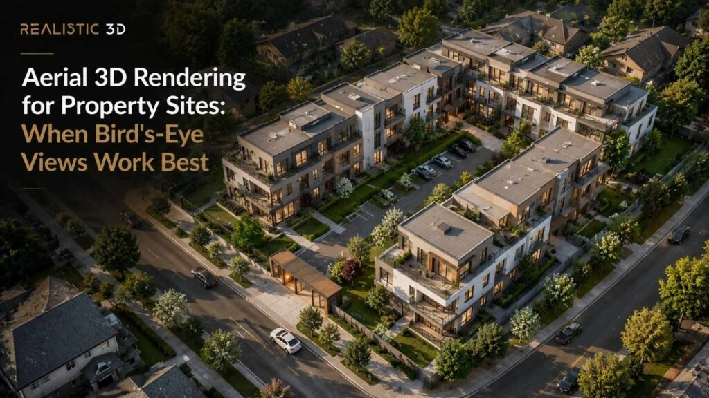
Aerial 3D rendering shows a proposed building or development from an elevated virtual camera so viewers can understand the project and its surrounding site in one image. It is most useful when layout, scale, access, landscape, neighbouring context, roof form, or the relationship between several buildings matters more than human-scale façade detail.
Aerial views are common in residential estates, mixed-use developments, commercial sites, industrial parks, campuses, resorts, infrastructure projects, and masterplans. They can support design communication, stakeholder review, planning material, investor presentations, and property marketing.
But an aerial view is not automatically the best view.
Raise the camera and you gain orientation. Raise it too far and buildings become small objects on a map. Tilt the camera down and the site becomes easier to read. Tilt it too far and façades, entrances, and street character disappear.
That tradeoff is the key to useful aerial 3D rendering.
This guide explains the different types of aerial views, how site context is built, how CGI differs from drone photography, what makes an aerial accurate, when aerial imagery helps planning communication, and how to choose a camera that answers the right project question.
For the wider set of exterior camera options, see our guide to 3D exterior rendering services.
What is aerial 3D rendering and how is it different from other views?
Aerial 3D rendering is architectural visualization created from a virtual camera positioned above a proposed building, site, or development. The elevated viewpoint can show the project footprint, roofscape, roads, landscape, neighbouring buildings, amenities, parking, circulation, and wider context that may be hidden from eye level.
The term covers several different camera positions.
A low oblique aerial may feel similar to a drone photograph taken above the site. A high bird’s-eye view may show an entire development. A near-vertical camera can look closer to a rendered site plan.
Chaos describes architectural aerial rendering as a way to show buildings and their surroundings from elevated viewpoints, including bird’s-eye and oblique perspectives. Its architectural aerial rendering guide also distinguishes aerial viewpoints by angle and purpose.
That distinction matters because aerial 3D rendering is not one fixed camera style.
What is a bird’s-eye view rendering?
Bird’s-eye view rendering is an elevated architectural image that looks down on a building or site from a steep angle. The term usually describes a higher and more downward-looking camera than a typical eye-level or low aerial view.
A bird’s-eye view is useful when viewers need to see:
- Several buildings at once
- Site boundaries
- Plot relationships
- Roads and access
- Parking
- Public realm
- Amenity spaces
- Landscape structure
- Roof form
- Open space
- Neighbouring development
- Water or terrain features
The steeper camera angle makes site organization easier to understand.
It also reduces the amount of façade and street-level experience visible in the image.
That is why bird’s-eye view rendering is often strongest as an orientation asset rather than the only marketing image.
Is an aerial render the same as a top-down site plan?
No. An aerial render and a rendered site plan can show similar information, but they use different visual logic.
A top-down site plan is usually close to vertical. It prioritizes location and arrangement.
An oblique aerial keeps more perspective. It lets viewers see roof form, façade depth, building height, landscape, and the relationship between vertical and horizontal elements.
| View type | Main strength | Main weakness |
|---|---|---|
| Eye-level render | Human experience and façade detail | Limited site overview |
| Low aerial | Building plus nearby site context | May not show the full development |
| Oblique bird’s-eye view | Strong balance of site layout and architecture | Less human-scale detail |
| High aerial | Large-site orientation and development structure | Buildings may become visually small |
| Near-vertical site view | Plot, road, landscape, and phase clarity | Weak sense of façade and height |
| Diagrammatic masterplan | Clear labels, phases, routes, and zones | Less realistic as a finished place |
A future article in this cluster will go deeper into masterplan rendering and 3D site plans. This article focuses on the elevated visual itself and how to choose it.
What is the difference between aerial 3D rendering and drone photography?
Aerial 3D rendering shows a proposed or future condition from a virtual camera. Drone photography records the real site at the time the photograph is taken.
That is the most important distinction.
A drone can photograph:
- Existing land
- Existing buildings
- Current roads
- Current vegetation
- Current surroundings
- Current construction progress
CGI can show:
- An unbuilt development
- Future buildings
- Proposed roads
- Planned landscaping
- Future public realm
- Alternative design options
- Phased development
- A completed site before construction finishes
The two methods can also be combined.
A visualization studio can use aerial photography as context and insert a proposed 3D model into it when the workflow is suitable. A site can also be reconstructed digitally from survey, mapping, photography, terrain, and model data.
For UK projects, drone capture is also a real flight operation, not just a camera choice. The UK Civil Aviation Authority drone guidance sets the rules for safe and legal drone use.
A virtual aerial camera has no airspace restriction. That does not mean the resulting CGI is automatically suitable as technical evidence.
What is drone-style rendering?
Drone-style rendering is CGI designed to feel like a plausible photograph taken from a drone.
The camera is usually lower than a very high bird’s-eye view. The image keeps enough perspective to show façades while revealing more site information than an eye-level camera.
A good drone-style rendering may include:
- Realistic camera height
- Natural perspective
- Plausible lens choice
- Atmospheric depth
- Realistic horizon
- Existing site context
- Controlled sun direction
- A photographic composition
This style is useful for property marketing because the visual language already feels familiar.
Buyers have seen drone photographs on property portals, development websites, and location campaigns.
The important point is disclosure.
If the image shows an unbuilt proposal, it should not be presented as though it were a real drone photograph of the completed project.
Is aerial CGI the same as masterplan visualization?
Not always.
Aerial CGI is defined mainly by camera position.
Masterplan visualization is defined mainly by the scale and purpose of the information.
A masterplan can be shown as:
- Realistic aerial CGI
- Diagrammatic site plan
- Isometric view
- Phasing diagram
- Interactive 3D model
- Animation
- Labelled sales plan
A single-building project can use aerial 3D rendering without being a masterplan.
A multi-phase urban development can use masterplan visualization without using a photorealistic aerial.
Autodesk describes master planning as a process that combines site analysis, design, 3D modeling, and visualization to communicate development plans to stakeholders. See Autodesk’s master planning overview.
The two categories overlap most strongly on large sites.
Why can aerial views explain a site faster than eye-level views?
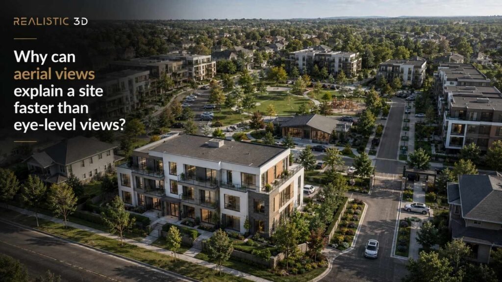
Aerial views reduce occlusion.
At eye level, buildings, trees, walls, and terrain hide what sits behind them. An elevated camera can reveal those relationships at once.
Imagine a housing development with 80 homes, a central park, two access roads, visitor parking, a play area, and a community building.
Five ground-level renders may each look convincing and still fail to explain the overall development.
One well-chosen aerial can show:
- Where the homes sit
- Which roads serve them
- Where open space is located
- How the community building relates to the park
- Which plots face green space
- Where the site connects to the surrounding area
This is why the job of aerial 3D rendering is usually orientation before emotion.
An eye-level render says, this is what the place may feel like.
An aerial says, this is how the place fits together.
What information is lost when the camera goes higher?
Human-scale information is lost first.
As camera height increases, viewers see less of:
- Entrances
- Shopfront detail
- Street furniture
- Façade texture
- Window depth
- Ground-floor activity
- Pedestrian experience
- Material joins
- Small landscape elements
- The emotional sense of arrival
At the same time, viewers gain more understanding of:
- Site footprint
- Building relationships
- Roads
- Roofs
- Plots
- Parking
- Open space
- Landscape structure
- Context
- Development scale
A useful rule is:
The higher the camera, the more orientation you gain and the more human-scale detail you lose.
That tradeoff should guide every aerial brief.
Which aerial camera should you choose for a property site?
Choose the aerial camera by deciding what the viewer must understand that an eye-level image cannot show. The four most important controls are camera height, camera tilt, context radius, and evidence standard.
Those four decisions determine whether the image becomes a marketing hero, a site overview, a masterplan-style view, or a more controlled planning visual.
1. How high should the aerial camera be?
Use the lowest camera that still reveals the relationships you need.
A camera that is too low may leave important buildings hidden.
A camera that is too high may turn the development into a small pattern of roofs.
A useful camera ladder looks like this:
| Camera level | Best for | Typical information visible |
|---|---|---|
| Slightly elevated | Single building or small plot | Façade, roof edge, entrance, immediate landscape |
| Low aerial | Development hero | Building form, site entrance, amenity, nearby context |
| Medium oblique aerial | Multi-building site | Roads, plots, landscape, building relationships |
| High bird’s-eye view | Estate, campus, industrial park | Full development structure and broader context |
| Near vertical | Site-plan communication | Plots, zones, roads, open space, phases |
There is no universal height in metres.
The correct height depends on site size, terrain, surrounding buildings, lens choice, and output purpose.
The camera is successful when the important relationship becomes obvious without making the development feel remote.
2. How steep should a bird’s-eye view be?
Use a steeper camera when horizontal site relationships matter more than façades.
A shallow oblique angle shows more building height and façade.
A steep angle shows more ground plane.
That gives you a simple choice.
Choose a shallower angle for:
- Development hero imagery
- Commercial marketing
- Resorts
- High-rise schemes
- Projects with strong roof form
- Sites where skyline matters
- Architecture-led campaigns
Choose a steeper angle for:
- Housing estates
- Masterplans
- Industrial compounds
- Campuses
- Logistics parks
- Plot sales
- Site access explanation
- Landscape and open-space strategy
A steep bird’s-eye view is not more informative in every case.
If the main value is a dramatic entrance, a high angle may hide the exact feature the image needs to sell.
3. How much surrounding context should an aerial render show?
Show enough context to explain the development’s relationships, but not so much that the project becomes visually irrelevant.
This is the context radius decision.
The required context may include:
- Adjacent streets
- Neighbouring buildings
- Public transport
- Water
- Parks
- Schools
- Retail
- Existing landscape
- Major roads
- Site boundaries
- Landform
- Nearby phases
- Key landmarks
Ordnance Survey describes mapping and imagery data as tools that provide visual context for urban planning, digital visualization, and geospatial analysis. Its maps and imagery products include aerial imagery, mapping, and topographic information that can support real-world context work in Great Britain.
Context should be chosen by relevance.
A motorway junction may be important for a logistics development.
A nearby station may be important for a residential project.
A school may matter to a family housing scheme.
A distant office block that has no bearing on the development may not need equal visual attention.
What is site context rendering?
Site context rendering is the process of representing the existing or proposed environment around the main development so the viewer can understand where the project sits.
Context can range from a simplified background to a detailed digital reconstruction.
Depending on the brief, a visualization team may use:
- Survey data
- Site plans
- GIS data
- Ordnance Survey data
- Existing CAD or BIM
- Aerial photography
- Drone imagery
- Street photography
- Photogrammetry
- LiDAR
- Terrain data
- Public mapping sources
- Manually modeled neighbouring buildings
Ordnance Survey’s MasterMap Imagery Layer provides high-resolution aerial imagery aligned with topographic mapping and is intended for uses that include planning, surveying, and site analysis.
The amount of detail should match the image purpose.
Marketing context can be simplified when distant objects only establish location.
Evidence-led context requires tighter control.
Should every neighbouring building be modeled accurately?
No. The required accuracy depends on visibility, importance, and intended use.
A neighbouring building directly beside the proposal may strongly affect:
- Scale
- Views
- Shadow
- Street enclosure
- Skyline
- Privacy
- Character
It may deserve detailed geometry.
A building two kilometres away may need only the correct mass and silhouette, or may be invisible in the final image.
The context model should use a detail falloff.
High detail near the proposal.
Controlled simplification farther away.
This keeps production efficient and the visual hierarchy clear.
For formal planning or landscape assessment, the methodology may require more rigorous context control than a campaign image.
Should the site boundary be visible?
Sometimes.
A visible boundary is useful when the audience needs to understand:
- Development extent
- Plot ownership
- Phase limits
- Landscape responsibility
- Parking allocation
- Sales parcels
- Development zones
It can be shown with:
- Subtle line
- Colour overlay
- Landscape edge
- Label
- Diagrammatic version of the aerial
- Separate companion site plan
Do not force a bright red boundary onto a photorealistic hero image if it damages the visual purpose.
One strong strategy is to create two outputs from the same camera.
First, a clean marketing aerial.
Second, an annotated information version.
That lets one scene support both emotion and explanation.
Should roads and vehicles be realistic?
Yes where they contribute to scale and site understanding, but they should not create false certainty about traffic performance.
Road width, junction geometry, access points, parking bays, pedestrian routes, and cycle infrastructure should follow the project information when they are part of the proposed design.
Vehicles can help show:
- Road use
- Scale
- Arrival
- Parking
- Loading
- Drop-off
- Movement hierarchy
But a CGI full of freely moving traffic does not prove traffic capacity.
A clear line must remain between visual communication and transport analysis.
The same principle applies to people.
People can make public realm understandable.
They do not prove future footfall.
How should landscape be shown from the air?
Landscape becomes unusually important in aerial 3D rendering because the camera exposes far more ground plane than an eye-level view.
From above, viewers can clearly see:
- Tree structure
- Lawns
- Planting beds
- Paths
- Courtyards
- Gardens
- Play areas
- Water
- Green roofs
- Buffer planting
- Open space
- Public realm
Poor landscape modeling can therefore weaken an otherwise strong aerial.
The landscape should match the project stage.
If the planting plan is approved, use it.
If it is conceptual, keep the visual representative.
Tree maturity also needs care. Large mature trees can make a new development look greener than the likely completion condition.
For formal visual assessment, landscape representation may need a defined time horizon and methodology.
The Landscape Institute’s visualisation guidance exists specifically to help professionals select visualisation methods that are appropriate for the circumstances in which they will be used.
How do terrain and level changes affect an aerial view?
Terrain can completely change how a development reads.
On a flat site, building relationships may be easy to understand from a site plan.
On a sloping site, the same plan may hide major differences in:
- Roof levels
- Retaining walls
- Views
- Road gradients
- Landscape terraces
- Building height
- Access
- Visibility
Aerial 3D rendering is especially valuable on sloping sites because a 3D view makes level relationships more intuitive.
The terrain model should come from the best available source for the job.
That may be:
- Topographic survey
- Civil model
- BIM site model
- GIS terrain
- LiDAR
- Contour data
Do not flatten meaningful terrain simply because the render becomes easier to compose.
How should the camera lens be chosen?
Use a lens that shows enough of the site without creating an exaggerated sense of scale.
Very wide virtual lenses can make nearby buildings look huge and distant parts of the site feel much farther away than they are.
Longer focal lengths compress depth.
The ideal lens depends on whether the image is meant to feel:
- Photographic
- Diagrammatic
- Expansive
- Compressed
- Heroic
- Neutral
For a drone-style marketing image, a plausible photographic lens often helps.
For a large masterplan overview, a more diagrammatic approach may be clearer.
The lens should serve understanding rather than spectacle.
Can one aerial view do everything?
Rarely.
One camera may be strong for the whole site but weak for the entrance.
Another may show the architecture well but hide the landscape strategy.
For large sites, a useful set might include:
- Development hero aerial
- High site overview
- Eye-level arrival view
- Key public-realm view
- Separate masterplan or labelled site plan
The aim is not to maximize image count.
It is to remove blind spots.
Our residential architectural rendering guide explains how development visuals can work together across plot layout, house types, street character, and buyer communication.
How is aerial 3D rendering created and what makes it trustworthy?
Aerial 3D rendering is created by combining the proposed design model with enough site, terrain, infrastructure, landscape, and surrounding context to support the selected camera. The studio then prepares materials, lighting, vegetation, roads, people, vehicles, atmosphere, and post-production before checking the image against the current project information.
The challenge is scale.
A ground-level render may show one façade and 30 metres of landscape.
An aerial may expose several square kilometres.
What files are needed for aerial 3D rendering?
The ideal source package depends on site size and required accuracy.
Useful files may include:
- Architectural BIM or CAD
- Site plan
- Masterplan
- Civil engineering model
- Topographic survey
- Landscape plan
- Roads and parking plan
- Plot schedule
- Building models
- Terrain data
- GIS or mapping data
- Aerial photography
- Drone photography
- Site photography
- Planning boundary
- Phasing plan
- Material schedules
- Existing context model
- Camera or viewpoint brief
A site render can start from 2D information if the required geometry can be reconstructed.
A large masterplan with complex levels becomes much easier when the visualization team receives coordinated 3D and survey information.
How is the site model built?
The site model is usually assembled in layers.
A typical structure is:
- Terrain
- Roads and hardscape
- Proposed buildings
- Existing buildings
- Landscape
- Parking and vehicles
- Street furniture
- Water
- Wider context
- Atmospheric background
The exact workflow varies by software and data source.
Large projects often combine information from several design tools. Epic Games describes an urban-planning visualization by Egis where context was built from OpenStreetMap, a topographic survey, open data, and infrastructure models before being brought together in Twinmotion. See the Twinmotion urban planning case study.
That example shows why aerial context is rarely one file.
It is an assembly.
Why does aerial rendering require different model detail from eye-level CGI?
Because the camera sees more objects but fewer small details.
An aerial may include hundreds of buildings, cars, trees, street lights, roofs, roads, and landscape zones.
Modeling every object to close-up quality would waste time and computing resources.
The visualization team should allocate detail by:
- Camera distance
- Visual importance
- Silhouette
- Shadow
- Material visibility
- Evidence requirement
- Potential reuse in other views
A nearby roof terrace may need detailed furniture.
A distant warehouse may need only accurate form and colour.
A landmark on the horizon may need a recognizable silhouette.
This is the same detail-falloff principle used in other visualization work, but it becomes essential at aerial scale.
How can real mapping data improve site context?
Mapping data can help establish the position and relationship of real-world features.
Useful data may include:
- Roads
- Buildings
- Water
- Green space
- Boundaries
- Terrain
- Land use
- Transport
- Building heights
- Aerial imagery
Ordnance Survey states that its mapping products cover features such as buildings, roads, natural spaces, terrain, transport networks, and imagery. Its OS data products can provide useful geographic context for UK projects.
Data still requires interpretation.
A mapping footprint does not automatically give you a photorealistic building.
Aerial imagery does not automatically tell you future planting.
A public dataset may be current enough for broad context but not for a planning-critical boundary.
Use the right source for the required confidence level.
Can photogrammetry or LiDAR be used?
Yes.
Photogrammetry reconstructs geometry from photographs. LiDAR records spatial measurements using laser scanning.
Both can help build large-scale context when suitable data is available.
Modern real-time and reconstruction workflows can combine aerial imagery, terrestrial data, and LiDAR to create 3D context. Epic Games’ RealityScan platform describes workflows that combine aerial imagery and aerial LiDAR for orthographic maps and 3D models.
These tools can reduce manual modeling.
They do not remove the need to check:
- Capture date
- Resolution
- Alignment
- Missing areas
- Vegetation
- Moving objects
- Surface quality
- Coordinate systems
- Licensing
A reconstructed context mesh may be excellent in the middle distance and unsuitable for a close foreground façade.
How is lighting handled across a large aerial scene?
Lighting needs to work at both building scale and landscape scale.
Aerial daylight scenes often rely on clear sun direction because shadows help viewers read:
- Building height
- Roof form
- Trees
- Road edges
- Terrain
- Public realm
- Separation between blocks
Flat midday light can make a large site visually confusing.
Very dramatic low sun can create long shadows that hide roads or landscape.
The best time of day depends on the job.
For a planning-style site overview, neutral daylight may be clearest.
For a launch hero, warmer morning or evening light may create more atmosphere.
For a dusk aerial, the visualization team also needs to coordinate building lights, street lights, landscape lights, car lights, and ambient sky brightness across a much larger scene than a single-building render.
What makes aerial CGI look fake?
Aerial CGI often looks fake when the project and its context feel as though they came from different worlds.
Common problems include:
- Proposed buildings are sharper than everything around them
- Context scale is wrong
- Roads are too clean
- Trees repeat visibly
- Cars repeat
- Roof materials lack variation
- Shadows do not match
- Aerial photography and CGI use different light
- Horizon haze is missing
- Terrain is too flat
- Landscape is too mature
- Neighbouring buildings are oversimplified
- The site edge is visually abrupt
- People are visible at impossible scale
- Context photography has the wrong perspective
The solution is not simply more detail.
It is consistency.
The proposal and context need to agree on scale, camera, light, atmosphere, colour, and level of finish.
For a wider look at realism, see our guide to what makes photorealistic interior rendering look real. The same core principles of scale, material, light, camera, and context also apply outdoors.
Can AI create an aerial rendering from a plan?
AI tools can generate aerial-looking imagery from plans, sketches, screenshots, or prompts.
That can be useful for:
- Concept ideation
- Early mood exploration
- Fast visual alternatives
- Landscape ideas
- Style exploration
The limitation is design control.
A generated image may invent:
- Roads
- Building massing
- Windows
- Roofs
- Landscape
- Parking
- Boundaries
- Neighbouring context
That makes it risky when the purpose is to communicate a specific approved development.
For concept work, invention may be acceptable.
For sales, planning, investor, or stakeholder material tied to a defined scheme, geometry needs much tighter traceability.
The closer the image moves toward evidence, the less tolerance there is for uncontrolled invention.
Can aerial rendering be used for planning applications?
Yes, aerial 3D rendering can support planning communication when it accurately represents the proposal and the relevant context. It should not automatically be treated as a verified planning view.
This distinction matters.
A marketing aerial is usually composed to make the development easy and attractive to understand.
A verified or assessment-led visual may need controlled:
- Viewpoint
- Camera data
- Survey data
- Field of view
- Position
- Context
- Scale
- Methodology
- Presentation
The Landscape Institute says visualisations should be selected and produced according to their circumstances and should support clear, transparent communication and informed decision-making. Its visualisation of development guidance is an important reference for UK landscape and visual assessment work.
Our guide to 3D rendering for planning permission explains the difference between persuasive architectural imagery and evidence-led planning visualization in more detail.
Does a bird’s-eye view help win planning approval?
A bird’s-eye view can help explain a planning proposal. It cannot guarantee approval.
It may make it easier to understand:
- Development extent
- Relationship to neighbours
- Site access
- Open space
- Building mass
- Landscape
- Public realm
- Parking
- Roof design
- Phase structure
Those are communication benefits.
The planning decision depends on policy, design, technical evidence, consultation, local context, and many other factors beyond a rendering.
This is why claims such as aerial renders win approvals are too strong.
A better claim is that the right aerial can make a complex site easier to assess.
When should property developers use aerial rendering and when should they avoid it?
Property developers should use aerial 3D rendering when the value, complexity, or risk of a project depends on relationships across the site rather than one isolated building face. It is most valuable for large developments, plots, masterplans, industrial sites, campuses, resorts, mixed-use projects, and schemes where access or landscape is central.
Avoid using an aerial as the main image when the decision is mainly human-scale.
When is aerial 3D rendering best for residential development?
Aerial 3D rendering is useful for residential developments with multiple homes, blocks, plots, roads, gardens, or shared amenities.
A well-chosen view can show:
- Plot layout
- House types
- Apartment blocks
- Roads
- Visitor parking
- Gardens
- Open space
- Play areas
- Community buildings
- Landscape
- Connections to the surrounding area
For buyers, the image may answer where does my home sit?
For developers, it may answer how should the whole scheme be presented?
For investors, it may explain scale.
For design teams, it may expose relationships that are hard to read across separate plans and elevations.
Our residential architectural rendering guide covers the wider visual package for builders and new-build developers.
When is an aerial useful for commercial property?
Commercial sites often depend on access and surrounding relationships.
Aerial CGI can be useful for:
- Office campuses
- Business parks
- Retail parks
- Data centres
- Hotels
- Industrial estates
- Warehouses
- Logistics sites
- Mixed-use developments
- Large hospitality sites
For a warehouse or business park, the roof may not be the most visually attractive part of the project.
The aerial is still useful because it can explain:
- HGV access
- Loading
- Parking
- Yard space
- Building placement
- Road hierarchy
- Landscape buffers
- Neighbouring plots
That can be more informative than a cinematic façade close-up.
For commercial projects where stakeholder understanding is central, see our guide to commercial architectural rendering.
Why are aerial views useful for industrial and logistics sites?
Industrial and logistics projects are spatial systems.
They may contain:
- Large footprints
- Service yards
- Gatehouses
- Separate vehicle routes
- HGV turning areas
- Loading doors
- Car parking
- Staff access
- Landscape buffers
- Utility zones
- Multiple buildings
Aerial 3D rendering can bring those parts into one visual.
The image should still avoid implying technical performance that has not been tested.
Showing a truck route does not replace swept-path analysis.
Showing parking does not replace a parking schedule.
Showing landscape buffers does not replace the landscape plan.
The aerial makes information visible. It does not replace the underlying evidence.
When should a masterplan use aerial CGI?
Use aerial CGI when a masterplan needs to feel like a future place rather than only a diagram.
A photorealistic aerial can help viewers understand:
- Density
- Building character
- Public realm
- Landscape
- Water
- Street hierarchy
- Mixed uses
- Development scale
- Relationship to context
A diagrammatic plan may still be clearer for:
- Plot numbers
- Phases
- Land uses
- Routes
- Sale status
- Delivery sequence
- Development zones
The strongest masterplan communication often uses both.
One image shows the place.
Another explains the system.
Our existing guide to architectural flythroughs for masterplans explains how moving aerial cameras can extend this idea when a single overview cannot explain a large site.
When is aerial rendering useful for property marketing?
Aerial rendering is useful for property marketing when location within the development is part of the value proposition.
Examples include:
- Homes facing a park
- Apartments beside a river
- Villas around a central amenity
- Hotel rooms connected to resort facilities
- Retail units beside a major access point
- Offices near transport
- Homes positioned away from a main road
- Plots beside green space
A marketing aerial can also become a navigation asset.
The clean hero image can be adapted into:
- Plot selector
- Availability map
- Annotated amenity plan
- Brochure spread
- Website section
- Sales-suite display
- Investor slide
- Animation starting frame
That reuse makes camera planning more important.
Choose an angle that can support information layers later.
When should a developer use eye-level rendering instead?
Use eye-level rendering when the viewer needs to judge the project from the position a person is likely to experience it.
Eye-level is usually better for:
- Main entrance
- Street frontage
- Façade materials
- Shopfronts
- Ground-floor activity
- Pedestrian public realm
- Landscaping at human scale
- Residential streets
- Arrival
- Architectural detail
This is why an aerial should rarely replace every ground-level exterior.
It should complement them.
Our 3D exterior rendering services guide compares street-level, aerial, entrance, and dusk cameras in more depth.
When should you use animation instead of one aerial still?
Use animation when the site cannot be understood well from one fixed elevated camera.
A flythrough can move:
- From surrounding context toward the site
- Across several phases
- Through an entrance
- Around key buildings
- Over landscape
- Toward amenities
- Into a pedestrian-scale sequence
This helps large developments reveal information gradually.
A still is faster to scan.
Animation is better when sequence matters.
Realistic3D’s 3D animation for real estate guide explains how animation can sit inside a wider property marketing campaign rather than replacing the still-image package.
When should you avoid aerial 3D rendering?
Avoid commissioning an aerial simply because it looks expensive or cinematic.
An aerial may be the wrong first asset when:
- The project is one small interior
- Façade material is the main design question
- The entrance is the main sales feature
- The surrounding context adds little information
- The site is so dense that roofs hide the useful story
- Exact interior layout is the main decision
- The budget only allows one image and the buyer’s experience matters more than orientation
A one-building infill project may gain more from a believable street-level view than from a dramatic aerial.
Choose the camera by information value.
How many aerial views does a project need?
Many projects need only one strong aerial.
Large or complex developments may need two or more because different directions reveal different information.
Consider a second aerial when:
- The site has several access points
- One view hides an important building
- The development has clear north and south character
- Landscape is more visible from another direction
- Several phases need explanation
- A high overview and a lower hero image serve different audiences
Do not commission four aerials that differ only slightly.
Each camera should add new information.
How much does aerial 3D rendering cost?
The cost of aerial 3D rendering depends heavily on site size and context complexity.
Main cost drivers include:
- Number of buildings
- Availability of existing models
- Terrain
- Amount of surrounding context
- Landscape detail
- Roads and infrastructure
- Mapping or survey preparation
- Photomontage requirements
- Number of aerial cameras
- Final resolution
- Revision scope
- Whether the scene will also support animation
An aerial of one house on a simple plot is not comparable with a full mixed-use masterplan containing dozens of buildings.
For broader market pricing and the factors behind architectural visualization quotes, see our 2026 architectural 3D rendering cost guide.
What should you send to an aerial rendering studio?
Send the information that controls both the development and its context.
A useful brief includes:
- Current site plan
- Architectural model
- Building drawings
- Terrain or topographic survey
- Landscape plan
- Road and parking design
- Site boundary
- Nearby context data
- Aerial or site photographs
- Material references
- Desired camera direction
- Main landmarks to include
- Intended audience
- Intended use
- Whether the visual is illustrative or evidence-led
- Required labels or annotations
- Final dimensions
- Deadline
- Review contact
Most importantly, explain the question.
For example:
The image should show how Blocks A, B, and C sit around the central park and how the main access road connects to the development.
That is far more useful than:
Please create a bird’s-eye view.
How can you review an aerial render in 60 seconds?
Review it in this order.
1. Development identity
Can you immediately see which part of the image is the proposed scheme?
2. Orientation
Can you understand the site’s basic structure?
3. Access
Are roads, entrances, parking, and main pedestrian relationships readable where relevant?
4. Building relationships
Do the blocks, plots, roofs, and open spaces match the current design?
5. Context
Does the surrounding site look consistent and appropriately detailed?
6. Landscape
Are trees, paths, open space, and public realm shown at a believable stage?
7. Camera
Is the view high enough to explain the site without making the project too small?
8. Evidence
Is the image being used at the right level of certainty for marketing, design, planning, or another purpose?
That final question is easy to miss.
A beautiful aerial can be accurate enough for one purpose and not rigorous enough for another.
Frequently asked questions about aerial 3D rendering
What is aerial 3D rendering?
Aerial 3D rendering is architectural CGI created from an elevated virtual camera. It shows a proposed building or development together with more of its site and surrounding context than an eye-level view can reveal. Aerial renders are commonly used to explain roads, plots, landscape, parking, building relationships, roof form, open space, and the overall scale of a development.
What is a bird’s-eye view in architectural rendering?
A bird’s-eye view is a steep elevated view looking down on a building or site. It gives more emphasis to the ground plane, site layout, roofs, roads, landscape, and relationships between buildings. A lower oblique aerial shows more façade and architectural character, while a steeper bird’s-eye view gives stronger site orientation.
Is aerial rendering the same as drone photography?
No. Drone photography captures the existing real site with a physical camera. Aerial rendering uses a virtual camera inside a 3D scene and can therefore show a project before it is built. The two can be combined when real aerial photography is used as context for CGI, but the final image should clearly communicate that the proposed development is computer-generated.
Can aerial 3D rendering be used for planning permission?
Yes, aerial 3D rendering can support planning communication when it accurately represents the development and relevant context. A marketing aerial should not automatically be treated as a verified visual. Formal landscape, townscape, or planning assessment may require controlled viewpoints, survey information, camera data, scale, photography, and a documented methodology.
What projects benefit most from bird’s-eye view rendering?
Bird’s-eye view rendering is most useful for projects where site relationships matter. Examples include housing estates, apartment developments, mixed-use masterplans, campuses, industrial parks, warehouses, resorts, retail parks, large commercial sites, and infrastructure schemes. A small infill building may gain more from an eye-level render if street presence is the main question.
How is site context created for an aerial render?
Site context can be built from architectural and civil models, surveys, GIS data, mapping, terrain, aerial photography, drone imagery, photogrammetry, LiDAR, site photographs, and manually modeled surroundings. The required detail depends on distance and intended use. Nearby buildings may need accurate geometry, while distant context can often be simplified.
How high should an aerial rendering camera be?
There is no fixed correct height. Use the lowest camera that still reveals the site relationships the viewer needs to understand. Low aerials preserve more façade and atmosphere. High bird’s-eye views reveal more roads, plots, landscape, and development structure. If the camera goes too high, the project can become visually small and lose human-scale meaning.
What is the difference between aerial rendering and masterplan rendering?
Aerial rendering is defined mainly by an elevated camera position. Masterplan rendering is defined by the need to explain a large development as a system. A masterplan may use aerial CGI, a rendered site plan, diagrams, labels, phasing graphics, animation, or interactive 3D. A single building can have an aerial render without being a masterplan.
Conclusion
Aerial 3D rendering is most useful when the site matters as much as the building.
It can turn a complex development into one readable view, showing where buildings sit, how roads enter, where landscape connects, how plots relate, and what surrounds the proposal.
The key is not to push the camera as high as possible.
Choose the lowest useful height. Tilt it only as far as the site question requires. Model the context to the level the image needs. Match the evidence standard to the purpose.
Then use eye-level views for the human-scale story the aerial cannot tell.
A good bird’s-eye view does not simply show more.
It shows the relationships that matter.
